March to the Sea Heritage Trail
Interpretive Marker Sites
®
March to the Sea
..the story
The Right Wing
R1. Little Cotton Indian Creek
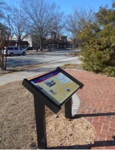
R2. McDonough (City) Square
McDonough (City) Square - Union Major General Peter J. Osterhaus' entire 15th Corps, over 16,000 strong, camped in and around this city on November 16, 1864, doing considerable damage.
GPS: 33.4471, -84.1470
R3. Locust Grove
Locust Grove - Leaving McDonough on November 17, 1864, the Federal 15th Corps and cavalry passed through here. Two infantry divisions continued south, and two turned east, with the cavalry feigning toward Macon.
GPS: 33.3520, -84.1135
R4. Sylvan Grove Plantation
Sylvan Grove Plantation - Today a hospital is located on part of this former plantation which 17th Corps commander Union Major General Francis P. Blair, Jr. used as his overnight headquarters on November 17, 1864. Its owners fled and endured a harrowing experience.
GPS: 33.3033, -83.9779
R5. Jackson
Butts County Courthouse - On November 17, 1864 the county seat of Jackson was headquarters for the Federal “Right Wing” (15th & 17th Corps) led by Union Major General Oliver O. Howard. Numerous acts of destruction were countered by several selfless deeds.
GPS: 33.2946, -83.9665
R6. Indian Springs
(replacing Ocmulgee River)
Indian Springs - Two divisions of the Federal 15th Corps camped in this community on November 18, 1864 en route to their crossing of the Ocmulgee River. Decades earlier an artesian spring attracted Native Americans. Their chief, William NcIntosh, built a hotel near the spring in 1823.
GPS: 33.2445, -83.9205
R7. Hillsboro
Hillsboro - Birthplace of U.S. and later Confederate senator Benjamin H. Hill, it was headquarters for the Federal 15th Corps the night of November 19, 1864, including for “Right Wing” commander, General Howard. The entire Right Wing passed through Hillsboro between November 19th and 21st.
GPS: 33.1768, -83.6392
R8. Battle of Sunshine Church
Battle of Sunshine Church - On July 31, 1864 as Federal cavalry under Major General George Stoneman were returning north from a raid (during the Atlanta Campaign) they were defeated here by Confederate Brigadier General Alfred Iverson's cavalry. The Federal 15th Corps subsequently burned the original church the next November during their March to the Sea.
GPS: 33.1090, -83.6162
R9. Clinton
Old Clinton - Clinton became a manufacturing center and was once Georgia’s fourth largest town. After the railroad bypassed Clinton it evolved into a peaceful village with many antebellum homes. In July and November 1864 a total of about 22,000 Federal troops were in the area.
GPS: 32.9968, -83.5593
NEW - Macon Defensive Fortifications
Macon Defensive Fortifications - As Federal armies penetrated into Georgia, Macon hastily constructed an impressive ring of defensive fortifications. General Sherman largely by-passed the city in 1864, but General Wilson did not in 1865.
GPS: 32.8517, -83.6364
R10. Macon City Hall
Macon City Hall - Built in 1837, City Hall was used as a Civil War hospital, then as Georgia's temporary capitol building during and after the March to the Sea. It was also a Confederate surrender site on April 20, 1865.
GPS: 32.8363, -83.6323
R11. Griswoldville
The Town of Griswoldville - Samuel Griswold made cotton gins, operated a saw mill and other facilities here before the war. During the war he manufactured Navy revolvers and other munitions for the Confederacy. The town was destroyed by Federals in November 1864 and was never rebuilt.
GPS: 32.8709, -83.4889
R12. Gordon
Gordon - Founded in 1843 with the first Central of Georgia train service, much of the original town was destroyed in July 1864 by Stoneman's raiders followed by portions of Union Major General Oliver O. Howard's 28,000-man “Right Wing” between November 22 and 25, 1864.
GPS: 32.8818, -83.3340
R13. Union Church
Union Church - Built between 1854 & 1856, this church was shared by three denominations. It was used as a granary by the Federal 15th Corps on November 24 & 25, 1864.
GPS: 32.8136, -83.1708
R14. The Defense of Ball’s Ferry
Ball’s Ferry - After two skirmishes here on November 24 & 25, 1864, the Federal “Right Wing” forced a small Confederate force to retreat. This enabled two pontoons bridges to be constructed allowing the entire 15th & 17th Corps to cross the Oconee River on the 26th.
GPS: 32.7835, -82.9587
NEW - Ball's Ferry/East Bank
NEW - Wrightsville
R15. New Hope Methodist Church
New Hope Methodist Church - Founded in the late 1700s, this historic church was damaged but survived being occupied and surrounded by the camps of the Federal 17th Corps, accompanied by General Sherman, on November 28, 1864.
GPS: 32.9308, -82.6000
NEW - Tarver's Mill
Tarver's Mill - General Sherman and the Federal 17th Corps stopped at this mill on November 29, 1864, which was made famous by a drawing that subsequently appeared in Harper's Weekly magazine.
GPS: 32.8981, -82.5296
R16. Bartow (Speir’s Turnout)
Bartow (Speir’s Turnout) - The town was renamed for Confederate Colonel Francis Bartow, killed at the First Battle of Manassas. Part of the 20th Corps destroyed the railroad here on November 28, 1864. The following day General Sherman rode just south of town with the 17th Corps on the (Old) Savannah Road.
GPS: 32.8796, -82.4744
R17. The Savannah Road
Old Savannah Road - The Federal 17th Corps, accompanied by General Sherman, camped along this historic road on November 29, 1864. The next day they continued east through the “Pine Barrens” and “Wiregrass” region of central Georgia.
GPS: 32.7974, -82.332
R18. Pine Barren Crossroads
Pine Barren and Wiregrass - the Federal 17th Corps turned north here to cross the Ogeechee River. Two 15th Corps divisions followed from the south, turning east on the Savannah Road. Some 20,000 men passed through this crossroads.
GPS: 32.7842, -82.2445
R19. Millen Junction
Millen Junction - An important railroad hub linking Savannah, Macon and Augusta, this town was entered by the more than 11,000 soldiers of the 17th Corps on December 2 & 3, 1864. The Federals burned the impressive depot, hotel and warehouses then turned south to continue their march.
GPS: 32.8023, -81.9396
R20. Little Ogeechee Church (Oliver)
Little Ogeechee Church (Oliver) - 4,000 Confederates led by Major General Lafayette McLaws entrenched here to block the Federal 17th Corps from crossing Little Ogeechee Creek. They retreated on December 4, 1864 when outflanked.
GPS: 32.5192, -81.5331
R21. Guyton Confederate General Hospital
Guyton General Hospital - This Confederate hospital was opened in 1862, expanding to 270 beds with a staff of 67 before closing upon the approach of Federal troops in December 1864.
GPS: 32.3317, -82.3932
R22. Pooler Station
Elevated Tent Camps - The Federal 17th Corps arrived in this low-lying area on December 9, 1864, requiring many small mounds to be built before making camp. About 1/2 mile to the east on the railroad was a Confederate heavy artillery battery. One of its shots narrowly missed General Sherman.
GPS: 32.0933, -81.2123
R23. The Savannah and Ogeechee Canal
Savannah & Ogeechee Canal - On December 8, 1864, Union Brigadier General John M. Corse’s division of the 15th Corps moved down the east side of the Ogeechee River to the canal, drove away a tiny Confederate force, rebuilt a burned bridge and camped before continuing toward Savannah.
GPS: 32.0236, -81.3174
R24. Nicholsonboro
R25. Ways Station
Ways Station - Now known as the City of Richmond Hill, this area was originally named Ways Station #1-1/2 when established in 1856. An important transportation juncture to Fort McAllister and south Georgia, the railroad through this area was destroyed by Federal troops by mid-December 1864.
GPS: 31.9455, -81.3064
R26. Cherry Hill Plantation
Cherry Hill Plantation - This thriving rice plantation was substantially destroyed by Federal troops in mid-December 1864 on their way to capture Fort McAllister. The Richmond Hill Historical Society Museum is now located on the property in a structure originally built by automotive giant Henry Ford.
GPS: 31.9305, -81.2978
The Left Wing
L1. Stone Mountain Cemetery
Stone Mountain Cemetery - Over 200 Confederate veterans are buried here. The nearby massive monolith “Stone Mountain” was admired by the 27,000+ Federal soldiers in the “Left Wing” of Major General William T. Sherman’s army as they marched east from Atlanta on November 15 & 16, 1864.
GPS: 33.8122, -84.1714
L2. Conyers Station
Conyers Station - The current depot succeeded one burned by Union Brigadier General Kenner Garrard’s cavalry on July 22, 1864. Then on November 17, 1864, the Federal 14th Corps was accompanied by Major General William T. Sherman as it marched through Conyers destroying rails.
GPS: 33.6664, -84.0179
L3. Old Church
Old Church (in Oxford) - Built in 1841 as a Methodist meeting house, Old Church was used as a war-time hospital. The church is adjacent to the slave quarters “Kitty’s Cottage,” with Old Emory College (Oxford College) located nearby. Federal troops were in Oxford multiple times during 1864.
GPS: 33.6252, -83.8709
L4. Covington Square
Covington Square - Some 14,500 Federal soldiers of the 14th Corps, commanded by Brigadier General Jefferson C. Davis, passed through Covington on November 18, 1864. They entered with bands playing, doing comparatively little damage following two cavalry raids the previous July.
GPS: 33.5965, -83.8601
L5. Hightower Trail (Philadelphia Church)
Hightower Trail (Philadelphia Church) - Philadelphia Church was a reference point on Civil War military maps along this famous Native American trading route. Approximately 14,000 men of the Federal 20th Corps marched past this landmark along the Hightower Trail on November 17, 1864.
GPS: 33.7322, -83.9735
L6. Centreville (Jersey)
Centreville (Jersey) - Known as Centreville in 1864, Brigadier General Alpheus Williams’ 20th Corps camped in and near this community the night of November 17-18, 1864, foraging liberally. The following day the Federals continued marching generally east on Hightower Trail toward Social Circle.
GPS: 33.7172, -83.7997
L7. Social Circle
Social Circle - The Federal 20th Corps marched through Social Circle along the Hightower Trail on November 18, 1864, destroying railroad tracks. The town’s depot and warehouses had been burned on July 23, 1864, during Union Brigadier General Kenner Garrard’s cavalry raid.
GPS: 33.6565, -83.7195
L8. Shady Dale
Shady Dale - This plantation community was heavily foraged on November 20, 1864 by the Federal 14th Corps, accompanied by General Sherman, while also liberating hundreds of jubilant slaves.
GPS: 33.4011, -83.5898
L9. Rutledge Station
Rutledge Station - The Federal 20th Corps, accompanied by “Left Wing” commander Major General Henry W. Slocum, arrived here on November 18, 1864. They destroyed the railroad and warehouses before camping that night east of town.
GPS: 33.6268, -83.6125
L10. Madison Station
Madison Station - The Federal 20th Corps arrived in Madison on November 19, 1864, destroying the railroad, depot and warehouses. Most homes were undamaged and today they represent much of Madison’s beauty and culture.
GPS: 33.5981, -83.4701
L11. The Oconee River Railroad Bridge
Blue Springs (Swords) - Union Brigadier General John W. Geary’s division of the 20th Corps marched east from Madison on November 19, 1864. It burned an important railroad bridge over the Oconee River and destroyed other properties before turning south the following day.
GPS: 33.5410, -83.2857
L12. Denham Tannery
L13. Putnam County Court House
Putnam County Court House - This community hosted numerous Confederate facilities, and was the hometown
of future Uncle Remus author Joel Chandler Harris. Two divisions of the Federal 20th Corps destroyed its railroad facilities on November 20, 1864.
GPS: 33.3259, -83.3894
L14. Old Governor's Mansion
Old Governor’s Mansion - Completed in 1839, the mansion was occupied by eight governors, including Joseph E. Brown, until the state capital was moved to Atlanta in 1868. It served as headquarters for General Sherman on November 23 & 24, 1864, and is now an impressive museum.
GPS: 33.0796, -83.2317
L15. Georgia State Penitentiary
Penitentiary Square - Burned by prisoners after many had been paroled to serve in the Confederate militia, and just prior to the arrival of nearly 29,000 soldiers in the Federal army’s “Left Wing” on November 22 & 23, 1864. This 20 acre campus is now home to Georgia College & State University.
GPS: 33.0808, -83.2302
L16. State House Square
State House Square - Georgia’s capitol grounds from 1807 to 1868, and now home to Georgia Military College, were damaged from the explosion of the State Magazine in November 1864. The impressive gothic styled former Capitol building has been restored and now houses a museum.
GPS: 33.0801, -83.2248
NEW - Buffalo Creek
NEW - Sandersville Old City Cemetery
L17. Washington County Courthouse
Washington County Courthouse - As the Federal Left Wing entered Sandersville on November 26, 1864, they were fired on from inside the courthouse by some of Confederate Major General Joseph Wheeler’s dismounted cavalrymen. The following day General Sherman ordered the courthouse burned. It was replaced after the war by the current building.
GPS: 32.9834, -82.8114
L18. The Brown House
The Brown House - Purchased in 1851 by the William Gainer Brown family, this house was used by General Sherman as his headquarters on the night of November 26-27, 1864. The house has been restored and is now operated as a museum by the Washington County Historical Society.
GPS: 32.9886, -82.8098
L19. Tennille Station
Tennille Station - General Sherman and his staff arrived in Tennille on November 27, 1864 to join his army's “Right Wing” for the remainder of their March to the Sea. Sherman witnessed the destruction of the town's railroad and warehouses. The present depot was built shortly after the War.
GPS: 32.9360, -82.8123
L20. Crossing the Ogeechee River
Ogeechee Crossing - Two divisions of the Federal 20th Corps escorting the Left Wing’s 1,200 wagons crossed the Ogeechee River here on November 28 & 29, 1864. Confederate cavalry and marshy ground continuously slowed their progress.
GPS: 32.9942, -82.4317
L21. The Sacking of Louisville
Sacking of Louisville - When the majority of the “Left Wing” halted to rebuild bridges across the Ogeechee River just west of Louisville a number of soldiers improvised a crossing. They entered town with few officers, looting and burning much of the town until the main army arrived to stop them.
GPS: 32.9998, -82.4088
NEW - Sparta
NEW - Jewell's Mill
NEW - Ogeechee Shoals
NEW - Cavalry Actions
L22. Augusta Arsenal
The Augusta Arsenal - Now the campus of Augusta State University, its administration buildings are the original United States Arsenal structures, founded on this site in 1826. Seized by Georgia militia in January 1861, it became a major Confederate manufacturing center until the war's end.
GPS: 33.4766, -82.0249
L23. Confederate States Powder Works
Confederate States Powder Works Chimney - This 153 foot tall chimney remains from the largest facility ever built by the Confederacy. Colonel George Washington Rains oversaw construction of multiple brick buildings, then production of some 3 million pounds of quality gun powder.
GPS: 33.4870, -81.9924
L24. Skirmish at Ivanhoe Plantation
Ivanhoe Plantation - Originating from a 1765 Crown Grant by King George III, a sharp skirmish occurred here on November 27, 1864 between the cavalrymen of Union Brigadier General H. Judson Kilpatrick and Confederate Major General Joseph Wheeler. Afterward the latter camped nearby.
GPS: 33.1253, -82.0645
L25. The J. D. Roberts Home
The Roberts House - This antebellum cottage, now the Burke County Museum, “witnessed” two cavalry clashes through the streets of Waynesboro on November 27 and December 4, 1864, respectively. The second battle ended with the burning of bridges over Brier Creek toward Augusta.
GPS: 33.0893, -82.0152
L26. Battle of Buck Head Creek
Big Buckhead Church - Built it 1855, this historic church witnessed the largest all-cavalry battle during the March to the Sea, involving more than 6,000 troopers, on November 28, 1864.
GPS: 32.9009, -82.0241
L27. Jacksonborough
Jacksonborough - The Screven County seat until 1847, the town was cursed and today only the 1815 Dell-Goodall House survives. Federal cavalry and most of the 14th Corps camped in this once prosperous community on December 5, 1864.
GPS: 32.8271, -81.6246
L28. The Incident at Ebenezer Creek
Ebenezer Creek - On December 9, 1864, after the Federal 14th Corps crossed on a pontoon bridge, its commander ordered the bridge removed before recently emancipated slaves could follow. Some troops tried to help, but a number of slaves drowned trying to swim to freedom.
GPS: 32.3797, -81.2088
L29. Savannah River Plantations
Savannah River Plantations - This rice-growing area along the Savannah River was occupied by Federal troops in December 1864. Two rifle & artillery duels with small Confederate gunboats ensued.
GPS: 32.1645, -81.1568
L30. Central of Georgia Railroad Complex
L31. Fort James Jackson
Fort Jackson - Constructed intermittently between 1808 & 1861, when seized by Georgia troops. Additional equipment was installed, surpervised by Confederate General Robert E. Lee. The fort was captured by Sherman's arny in December 1864.
GPS: 32.0811, -81.0367
Site numbers are as indicated in the
March to the Sea Heritage Trail brochure
Northeast Georgia - Coming Soon
Subscribe to Our
"Civil War Heritage Trails"
e-Newsletter

Honor Your Ancestors and Help Tell Their Story
Like This “March to the Sea” Page

We Will Never Share Your Information!
Unsubscribe Easily.

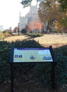
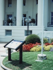
Interpretive marker at the
Old Capitol Building
on State House Square (L16)
in Milledgeville
Interpretive marker at
The Augusta Arsenal (L22)
on the campus of
Augusta University
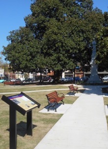
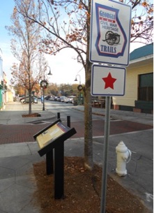
Interpretive marker in
Covington Square (L4)
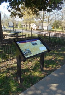
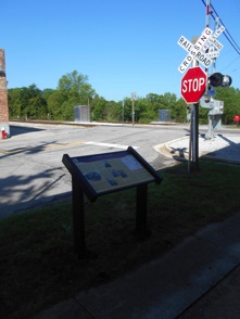
Interpretive marker in
Social Circle (L7)
Interpretive marker in Bartow (R16)
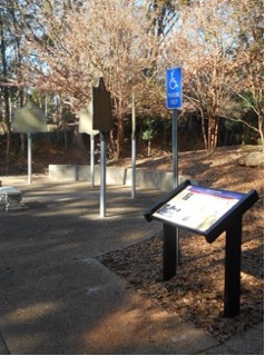
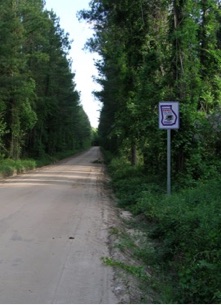
Trailblazer signs and interpretive marker near Midville at
Pine Barren Crossroads (R18)
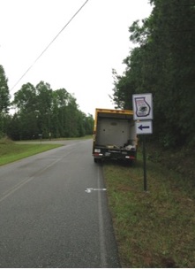
Trailblazer directional sign on Old Louisville Road
between Oliver and Guyton
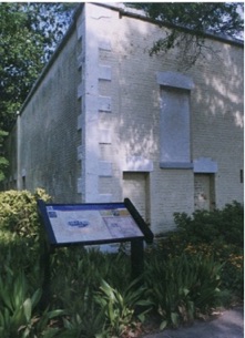
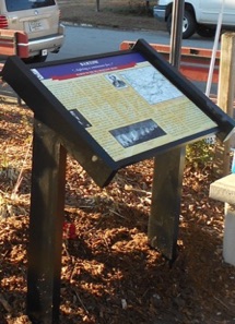
Interpretive marker in front of
Macon City Hall (R10)
Installing trailblazer directional signs near the Griswoldville battlefield
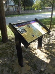
Interpretive marker and trailblazer signs at Conyers Station (L2)
Interpretive marker at
The Brown House (L18)
in Sandersville
Old Church (L3) interpretive marker
in Oxford
Old Clinton (R9) interpretive marker
next to older-style
historical markers near Gray
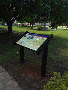
Interpretive marker "in the shade" at Shady Dale (L8)
Interpretive marker near railroad tracks at Madison Station (L10)
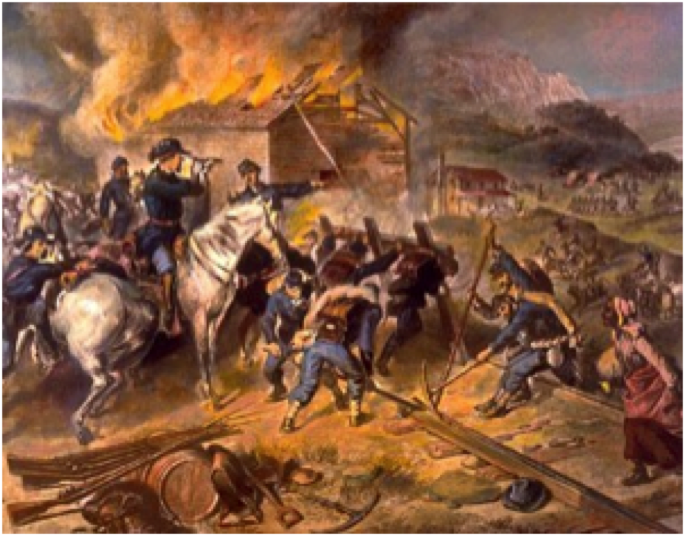
After Union Major General William T. Sherman captured Atlanta on September 2, 1864, he briefly pursued General John B. Hood’s Confederate army through northwest Georgia. Sherman then turned his army south toward Georgia’s largest city...Savannah. His now legendary “March to the Sea” ripped the heart out of the Confederacy, demoralized civilians, destroyed railroads, and denied Confederate authorities considerable food and other badly needed supplies.
Sherman’s army totaled 62,000 of his best soldiers, including 5,000 cavalry and 65 pieces of artillery. He estimated to reach Savannah would require six weeks, yet Sherman ordered only enough food for 20 days, to be carried by 2,500 wagons. Sherman’s plan was a dangerous gamble, because his army was cut off from any communication or chance for re-supply. So his troops foraged “liberally,” living mostly off the food they took from civilians. The worst foragers were labeled “bummers,” often stealing or destroying property indiscriminately.
Leaving Atlanta on November 15 and 16, 1864, the army split into two “wings” of between 28,000 and 29,000 each, with cavalry guarding their flanks. Marching along generally parallel routes, the two wings were often separated by between 20 and 40 miles. Separation avoided congestion, thus the army advanced quickly, and was allowed a larger area from which to forage. Separation also resulted in a broader swath of devastation across the center of Georgia, measuring up to 60 miles wide, and 300 miles long. Thousands of slaves followed, which the army discouraged, knowing they could neither feed them nor guarantee their safety.
Sherman’s two wings confused the Confederates. Major General Oliver O. Howard’s “Right Wing” advanced south to threaten Macon. Meanwhile, Major General Henry W. Slocum’s “Left Wing” feigned toward Augusta. Confederates split their paltry forces between the two cities, but Sherman ignored both. He concentrated much of his army around Milledgeville, Georgia’s capital city, then swept on toward Millen and Savannah, besieging the latter on December 10. After ten days the 10,000-man Confederate garrison, under Lieutenant General William J. Hardee, evacuated the vital seaport. Sherman wired President Abraham Lincoln afterwards saying, “I beg to present to you the City of Savannah” as a Christmas present.
Cavalry clashed frequently along the edges of Sherman’s march routes, and two sizable infantry battles occurred. On November 22, 1864, Georgia militia, untrained boys and old men, were slaughtered attacking Federal lines at Griswoldville near Macon. And on December 13, Sherman’s veterans overran Fort McAllister along the Ogeechee River, enabling the U.S. Navy to re-supply his army.
Sherman accomplished all his goals for his March to the Sea in only five weeks, inflicting one billion dollars worth of damages. “I can make Georgia howl,” Sherman had sworn, and he did.
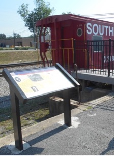
Interpretive marker adjacent to the
railroad museum in Gordon (R12)
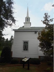
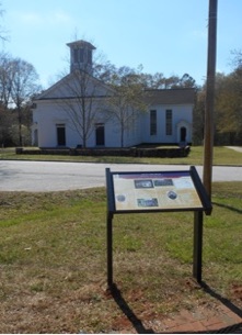
Interpretive marker next to
New Hope Methodist Church (R15
Little Ogeechee Church
interpretive marker (R20)
next to Old Louisville Road
Sacking of Louisville
interpretive marker (L21)
near the historic Market House
Driveway to the Dell-Goodall House and the Jacksonborough
interpretive marker (L27)
Download: March to the Sea Heritage Brochure